 TARRANT COUNTY, TX

 Tarrant County Archives
Jim McCreight Collection
Summary: Jim McCreight donated many North Texas maps and a photograph from the Tarrant County Sheriff's Office to the Tarrant County Archives.
Maps
- 1947 Ashburn's, Fort Worth City Map, city limits, street guide, enlarged business area, Lake Worth and Eagle Mountain lake, 10 ½ by 23 ½ inches
- 1949 Ashburn's, Fort Worth City Map, highways, street numbers, business section enlarged, enlarged Eagle Mountain and Lake Worth, 19 by 25 inches
- 1942 Cody's official map of Dallas, Texas, transportation services, street car, motor coaches, feeder coaches, highways, civic center, passenger depot, public buildings and hospitals, 19 by 24 inches
- 1967 Texaco, Fort Worth City map, state and national highways, surrounding communities, 19 by 28 inches
- 1963 Mobil, Fort Worth city map, state and national highways, surrounding communities, 18 by 28 inches
- 1957 Enco, Dallas-Fort Worth City map, state and national highways, sightseeing guide, index to communities, parks, clubs, 23 ½ by 33 inches
- 1970 Universal's Haltom-Richland area city map, street index, street names and index, block numbered, Tarrant and Dallas Counties enlarged
- Azle business directory and street guide, 17 ¾ by 23 ½ inches
- 1955 Official Texas highways map, 36 by 27 ½ inches
- 1959 Official Texas highway map, 36 by 27 ½ inches
- 1963 ENCI Texas highway map, sightseeing guide, recreation areas, enlarged area of principal cities, national interstate system 23 ½ by 33 ½ inches
- 1966 Texaco, Texas highway map, public recreational areas, inner state highways, parks, port of entry, airports, 23 ½ by 33 ½ inches
- 1962 Austin - San Antonio visitor guide, city map, street index, and points of interest, index to communities
- 1964 ENCO Oklahoma - Kansas highway map, sightseeing guide, 25 by 23 ½ inches
- San Antonio, Texas, 6 by 11 inches
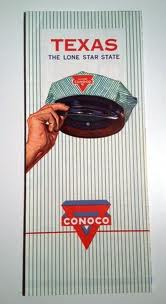
- Texas road map, 1960, published by Conoco Products
- Texas road map, 1964, published by Texaco Gasoline
- Texas official state highway map, 1971, published by the Texas State Highway Commission
- Texas road map, 1972, published by Mobil Travel Guide
- Greater Fort Worth City Map, including Arlington, Bedford, Euless, Grapevine, and Hurst, no date, published by R. L. Polk and Co.
- Fort Worth street map, no date, published by Rand McNally
- Fort Worth - Dallas street map, 1960, published by Humble Oil
Photographs
- 12 by 15 inches photo poster of individual photographs of members of the Tarrant County Sheriff's Department, January 1, 1929